Sunday, March 27, 2011

About Chitwan National Park

How can you get to Sauraha?
Chitwan National Park is approximately 160 Km from Kathmandu.  You can either drive from Kathmandu to Sauraha, which takes approximately 4 hours.  The quickest way to get to Sauraha is to take a short 25-minute flight from Kathmandu to Bharatpur airstrip, and then drive for another 25 minutes with buffer zone views all along the way.  The distance from Lumbini (the birthplace of Lord Gautam Budhha and a World Heritage Site) to Sauraha is just 155 Km and from Pokhara to Sauraha is 145 Km.
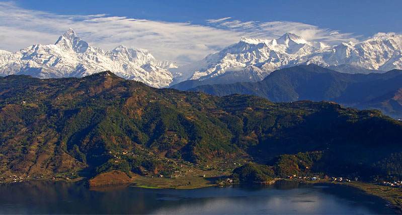
Sauraha is easily accessible by road from Kathmandu or Pokhara, a scenic five hour drive.  Visiting Sauraha on your return from Pokhara will save you a day’s travel between Pokhara and Kathmandu.
Another exciting option is to travel to the national park via a leisurely two-day rafting trip on Trishuli River.  The first day is thrilling introduction to whitewater followed by a day of scenic floating through gorges and the middle hills before dropping on to the Terai plains.
When is the best time to visit Chitwan?
Spring-February until end of April and Fall-Mid September till mid December.
Accommodation:
Chitwan National Park offers a wide variety of accommodation, not only in size, facilities and visual appearance, but also in price range.  If you are looking for exclusive comfort with superior personalized service right in the heart of the park-then visit Sauraha for a preview of private luxury and budget accommodation.
Recommended Activities:
Bird Watching:
An early morning walk through the bush and along the Rapti River is necessary going to view many of the exotic birds, including the Giant Hornbill, Lesser Florican and Paradise Flycatcher.  This part, enjoy the movement of the migratory birds in the Beeshazari Tal.  Our experienced naturalists will accompany you to this wonderful birder’s paradise.
Elephant Safari:
Seated high on the back of a trained elephant exploring the grasslands and core area of the park, you become an integral part of the life of the national park.  The elephant safaris, though not the most comfortable rides, is an amazing experience.  In addition, it does not take long to spot at least a rhino in these forests.
Elephant Bathing:
Just chill out beside the tranquility of the Budhi Rapti River and watch the appealing elephants taking a bath or if it is too tempting, join them while taking a dip down the river.

Jungle Drive:
Drive into the heart of the park for a good chance to spot the rare species.  The drive takes you along timeworn trails with great opportunities of viewing big animals.  Do not forget tomove on to Kasara-the park headquarters wherein you will get the chance to visit the Kasara Durbar and the Crocodile Breeding Centre.  The Centre is housed with a number of breeding and hatchling ponds to produce and rear the animals until they are ready to release in the wild.

Canoeing:
A journey down the Rapti River in a traditional ‘dug out canoe’ offers you the chance to quietly observe the exotic species of birds and animals that come for a sip at the water’s edge.
Observation Tower:
Be calm and quiet on the 22-feet high wooden tower built in the prime location of the park, which offers unique chances to see the movement of the animals in the wilderness.
Nature Walk:
Walk out and stretch your legs deep into the forest accompanied by professional naturalists as they share their extensive knowledge with you on your way to prime spots in quest of rare and endemic species.  Be on the look out for the great one-horned rhinoceros, wild boar, sloth bear, bison, gangetic dolphins, gharial crocodile and the Royal Bengal Tiger.
Elephant Breeding Centre:
Of all the animals, elephants are probably the most graceful.  Our naturalists will take you to the Hattisar to demonstrate how elephants’ meals are prepared and how they eat in the Elephant Breeding Centre.  They will explain the nature and habits of elephants.  The unique Centre was established in 1985 for the captive breeding of domesticated elephants to avoid the pressure of wild elephants trapping for domestication.

Tharu Stick Dance:
Savour the magnificent cultural dance of the Tharu communities watching by the bon fire in the evening in any of the hotels of Saurha.
Buffer Zone Village Tours:
Experience the uniquely placed culture of the Tharu people.  Relish what their culture is like in the Tharu Village Museum in the heart of Sauraha in Bachhyauli.  For centuries, the Tharus have lived very close to this protected area and hence their tradition reflects their intimate relationship with the natural world.  Visit the Tharu village and share their world with them as you reach out to touch another culture.
Specialized Tours:
Enjoy the specialized tours which are packed with information about the Chitwan National Park, its majestic wildlife, its successful buffer zone programmes, the holy places around especially the Dev Ghat, and the naturalists are here to share their knowledge of the park with you to enrich your stay in Sauraha.
For anyone who visits Chitwan National Park, it eventually becomes an addiction.  If you sit back and think about it, sometimes you wonder, why! Chitwan National Park has a long history behind it and has the unique honour of being Nepal’s first national park. Established in 1973 to protect the wildlife of the lowland Terai, this national park of 932 sq.km. is unrivalled in the diversity of its life forms and a leader in advanced biodiversity conservation techniques and policies.  Since then, there has been no looking back for Chitwan National Park-Nepal’s first and riches national park.
As a primary destination crowned as the World Heritage Site in natural category, the Chitwan National Park offers a wildlife experience that ranks with the best in Asia.  Truly, the flagship of Nepal’s national parks, Chitwan is home to an impressive number of species.  Man interacts with the environment over many centuries-is very evident in the Chitwan National Park.  These treasures represent the cultures, persons and events that played a role in the making of the park and are conserved along with the park’s natural assets.  The most easily accessible amongst Nepal’s national parks, Chitwan is considered by many naturalists to be simply the best-managed park in Asia.

Article of Chitwan National Park


Set against the backdrop of the Himalaya, the Chitwan Naional Park is home to an incredible variety of wildlife, including several endangered species.  Of all the world’s remaining forests, one of the most enchanting is Chitwan National Park in the himalayan Kingdom of Nepal.  Here inside the park, you will discover a lost world of towering trees and twisting vines, of pre-historic rhino and lumbering trees and twisting vines, of pre-historic rhino and lumbering elephants, of crocodile, python and deer;  of brilliantly colored birds and if you are fortunate-the superb Bengal Tiger.  Visit a wonderful world of lush riverine forests, tall elephant grass, lakes and rivers-home to some of the most endangered animals on earth, the elusive tiger and the prehistoric rhinoceros, including many speices of mammals, birds, insects and reptiles.  Around 400 one-horned rhinoceros make their home in the lush forests of Chitwan, along with several other wild species.
In the waters of the two mighty rivers that drain the Chitwan valley, the Narayani and the Rapti, you will find a diversity of riverine wildlife including the endangered fish-eating gharial crocodile and the marsh mugger crocodile.  Chitwan is a bird watcher’s paradise, with over 528 species of resident and migratory birds having been indentified so far.  The endangered Giant Hornbill, the Paradise Flycatcher, the Large-Pied Kingfisher and the Racquet-Tailed.
Drongo are among the more exotic resident birds in Chitwan.  Fore serious brid watchers, Beeshazari Lake (a Ramsar Site) provides a unique venue for watching migratory waterfowl, waders and shore birds that congregate from December to February every year.
An unbeatable feeling of being in the wild.  Experience a selection of well-appointed hotels in Sauraha that offers up-close-and comprehensive wildlife tours of three or more days.  There are a host of options to explore the park, accompanied by resident naturalist and guides: elephant-back safaris, canoe rides, jungle walks, bird-watching tours, and jeep drives.

Background - Chitwan National Park

Chitwan National Park is situated in south central Nepal in the sub tropical lowlands of the inner terai of Chitwan, Makawanpur, Parsa and Nawalparasi districts. It lies between 27°16.56’- 27°42.14’ Latitudes and 83°50.23’-84°46.25’ Longitudes. The altitude ranges from 110m to 850m above sea level. The park is bounded by the Rapti and Narayani River in the north, Parsa Wildlife Reserve in the east and Madi settlements and India border in the south. The physiography of the park consists of the Terai and Siwaliks. Three major rivers Narayani, Rapti and Reu, and their floodplains; and several lakes and pools are the major water sources of the park.


Being the first protected area of Nepal, it has a long history of over three decades in park management and rich experiences in nature conservation. Chitwan was a big game area for the royal families, Rana rulers and their guests. The area comprising the Tikauli forest from Rapti River to the foothills of the Mahabharat extending over an area of 175 km2 was declared as Mahendra Deer Park in 1959. The area south of the Rapti River was demarcated as a Rhino Sanctuary in 1963. It was proclaimed as Royal Chitwan National Park with an area of 932 km2 in 1973. After the peoples’ revolution in 2006, the park’s name was changed to Chitwan National Park.


In recognition of its unique biological resources of outstanding universal value, UNESCO designated CNP as a World Heritage Site in 1984. In 1996, an area of 750 km2 surrounding the park was declared a buffer zone, which consists of forests and private lands including cultivated lands. The buffer zone contains a Ramsar Site – Beeshazari Lakes.


The park and the local people jointly initiate community development activities and manage natural resources in the buffer zone. The government of Nepal has made a provision of plowing back 30-50 percent of the park revenue for community development in the buffer zone.
 

About Chitwan

Chitwan District is one of the seventy-five Districts of Nepal, a landlocked country of South Asia. The district is in the western part of Narayani Zone with Bharatpur, the seventh largest city of Nepal, as its district headquarters. It covers an area of 2,218 km2 (856 sq mi), and in 2001 had a population of 472,048 people. Bharatpur is a commercial and service centre of central south Nepal and merger destination for higher education, health care and transportation of the region.
The district takes its name from the Chitwan Valley, one of Nepal's Inner Terai valleys between the Mahabharat and Siwalik ranges, both considered foothills of the Himalayas.
Narayangarh, on the bank of Narayani River, is the main town with numerous shopping zones where people come from all over the district and neighbouring districts.
Now there are about 40 Village Development Committees (each of which has nine wards or villages) and one sub-Metropolitan city - Bharatpur and a municipality Ratnanagar each of which has more than nine wards or urban areas.
Chitwan is one of the few remaining undisturbed vestiges of the Terai region, which formerly extended over the foothills of Nepal

Origin
The name Chitwan is a composite of the Sanskrit words चित्त, transliterated "citta" meaning heart and वन, transliterated "vana" meaning jungle or forest.[1][2] Thus, the meaning of Chitwan is Heart of the Jungle.

Industry

Chitwan is famous in Nepal because of its dominant production of mustard from which mustard oil is produced. This popularity of the mustard plantation in Chitwan is attributed to the predominant soil type of the place. The soil in Chitwan is mostly of the type silt. The silty nature of the soil is in turn attributed to the flooding over the ages in the past from the rivers like Gandaki. Chitwan is also profusely spotted with lands with soil type clay which are very good for use as rice fields. Other popular cash crops in the region are maize and wheat. The soil there is also very good for growing various types of vegetables such as cabbage, cauliflower, radish, potato, broccoli, cucumbers, pumpkins, and carrot.
Chitwan hosts 80% of the country's poultry industry, and is also famous for floriculture, mushroom cultivation and bee keeping.
At present Chitwan's largest business area, Narayangarh, is less accessible due to the movement of the main bus terminal due to the previous king's son's anger with the politics of the citizens of the city. This bus terminal is however no longer in use following a successful people's movement in 2006. It is believed that Nepali leftist revolutionary leader Prachanda spent his childhood and youth in Chitwan. Chitwan is adapting South Korean model of development system called "Saemaul Undong or New Village movement" in Nepali context Nepal Saemaul Undong or Namuna Bikas Aviyan or Model Development Campaign at Piple Village of East Chitwan since 22 February 2003. ( Listen or read the text http://saemaul.com/english/video.asp )

Places of interest

Chitwan has a particularly rich flora and fauna. Nepal's first national park, the Chitwan National Park together with the adjacent Parsa Wildlife Reserve support a species diversity much higher than any other on the Indian subcontinent. Rare species include Bengal tiger, gharial and the world's second largest population of Asian Rhinoceros, but also leopards, Mugger crocodile, Indian rock python and several species of deer. The protected areas are guarded by a battalion of the Nepal Army and patrolled by seven anti-poaching units Das Dhunga is a famous place in Chitwan - the people's leader Madan Bhandari was killed there in an accident.
Chitwan is also famous for saiyatha basically Rambag (kabi Dada). Rambag is known as Kabi dada now. There are some famous kabi like-Surendra Astafal, Ganesh Sharman, Arjun Astafal, L.B Chhetri, Gopal Poudel, Nabaraj Dhungana. it is located south part of kalayanpur, west part of narayanpur, east part from fulbari and north part of kailashnagar. It is in Bharatpur municipality-13. Eighty five % of people in Rambag are service holder in government or private office. Ninety percentage people are literacy.

Chitwan National Park


River Along Chitwan National Park
When planning to travel to Nepal the first things most people imagine are usually the beautiful Himalayan mountains, trekking through them and the unique yet distinctly different cultures found throughout the country. Travel to the jungle might sound like an absurd option to some who want to vacation here, but for those that have done a little more research on Nepal's travel destinations are well aware of its varied terrain that includes alpine peaks, a hilly region, and tropical jungle as well.

Nepal's Chitwan National Park is not only one of the most
River Along Chitwan National Park
popular parks in the country but it is also the largest protected area as well. Chitwan caters to tourists in the fact that it is one of the most interesting, unique travel destinations in the country. This in mind, there are many Nepal travel websites filled with information about Nepal's most famous wildlife national park at Chitwan, but they explain little about the park by limiting the information to just travel activities. There are even more sites that claim the park as being an amazing organization for wildlife preservation, this may be true but that was not always the case. The Chitwan National Park is not just an ideal place to vacation, for the most part it always has been, but in its past it had a different view of what was a relaxing travel activity for those visiting the park.
Gharial Crocodile, Nepal
In the 1940's-1950 the Terai was owned by Nepal's Rana rulers who claimed the beautiful region for themselves and had Chitwan as their own royal and private hunting grounds. The kings would only invite who they thought were important government persons or other royalty from other countries to travel here and to participate in special hunting parties at their reserve. During such parties, hundreds of Bengal tigers, tens of one-horned rhinos, leopards, exotic birds and other animals like crocodiles and bears were killed, yet these outrageously high numbers of kills did not even put a dent in the population of these species (at first).

Over time with extreme hunting parties traveling through the park and collecting trophies like the one with King George V from England which had a recorded tally with up to 600 elephants alone – not including the other dozens of wildlife species claimed as glorious prizes.

Where the Rana reign thought they were providing large sections of high quality unspoiled habitat for the animals to flourish, the land alone was not enough. As the hunting reserve progressed the one-horned rhinos, usually prized solely for its horn, would have a fluctuation in population from 800 down to 100 in as little as 9 years.

One-Horned Rhino In Chitwan
With this magnificent and treasured animal population depleting, the kings ceased their hunting parties and made efforts to protect and restore Chitwan's rhino population. The preservation was enforced with a royally funded conservation project in 1959 and the numbers of the rhinoceros steadily increased. After the efforts and success with balancing this wild species population, the park took other steps to conserve not just the rhinoceros but the unique land that these animals call home. Chitwan was officially proclaimed a protected national park in 1973 and would eventually have the title of UNESCO World Heritage Site and would also be known to have one of the strictest anti-poaching policies around the world.

Tuesday, March 22, 2011

Introducing Pokhara


Boats, Phewa Tal, Pokhara
Imagine a perfect triangular mountain, capped by snow and buffeted by the icy winds of the Himalaya. Imagine a millpond calm lake, perfectly reflecting the snowy peaks. Now imagine a village on the lakeshore, thronged by travellers and reverberating to the sound of 'om mani padme hum' from a hundred shops selling prayer flags, carpets, masks, singing bowls and CDs of Buddhist mantras. That's Pokhara.
  Nepal's second city, at leastin tourist terms, Pokhara is the end point for the famous Annapurna Circuit trek and the starting point for a dozen more treks through the mountains of the Annapurna Range, including the perennially popular Jomsom Trek and the equally dramatic (but less busy) trek to the Annapurna Sanctuary. It's unashamedly touristy, in the Thamel mould, but the setting is spectacular - the perfect pyramid of Mt Machhapuchhare looms high above Pokhara, reflected in the placid waters of Phewa Tal.
For many travellers, Pokhara represents a last chance to stock up on creature comforts before hitting the mountain trails. For others, it's a place to enjoy a steak dinner and cold beer after weeks of daal bhaat in the hills. Even if you aren't a dedicated trekker, there's plenty here to keep you busy. Pokhara has numerous museums and there are some fascinating caves, waterfalls and Tibetan villages in the surrounding hills.
For the adventurous, travel agents in Pokhara offer a slew of adventure activities, from trekking and microlight flights to river rafting and jungle safaris. Paragliding from Sarangkot viewpoint has to be one of the most thrilling experiences in the subcontinent. Alternatively, bring a good book and spend your days reading in a café overlooking languorous Phewa Tal.

Monday, March 21, 2011

Phewa Lake

Phewa Lake, Phewa Tal or Fewa Lake is a lake of Nepal located in the Pokhara Valley near Pokhara and Sarangkot. It is the second largest lake inNepal and lying at an altitude of 784 m (2,572 ft) it covers an area of about 4.43 km2 (1.7 sq mi) with an average depth of about 8.6 m (28 ft) with maximum water depth is 22.8 m (75 ft) when measured with echo-sounder (depth measuring gauge; PLASTIMO ECHOTEST II) on 5 December 2009. Maximum water capacity of the lake is approximately 46 million cubic meters (37,000 acre feet).[1] Annapurna looms in the distance from the lake and the lake is famous for the reflection of Mount Machapuchare on its surface. The holy Barahi mandir (temple) is situated on the island located in between in the lake.
 
Phewa Lake in 1982
The eastern Pokhara Valley receives irrigation water through a canal running from a reservoir by the Seti River in the north of the city. Phewa Lake is also used for commercial fishing. The tourist area is along the north shore of the lake (Lake Side and Dam Side). It is mainly made up of little shops, little hotels, restaurants and bars. The larger hotels can be found on the southern and south-eastern fringes of the Pokhara city, from where the view of the mountains, mainly Machapuchare, or Fishtail Mountain, is seen best. To the east of the valley are few smaller and few bigger lakes, the largest being Begnas Tal and Rupakot Tal. Begnas Tal is also known for its fishery projects.
Phewa Lake was slightly enlarged by damming. It is in danger of silting up because of the inflow during the monsoon. The outflowing water is partially used for hydro power. The dam collapsed in the late 1970s and it was rebuilt by the Chinese.
from Sarangkot
LocationPokhara
Basin countriesNepal
Surface area4.43 km2 (1.7 sq mi)
Average depth8.6 m (28 ft)
Max. depth22.8 m (75 ft)
Water volume0.046 km3 (0.011 cu mi)

Thursday, March 17, 2011

Tourism and economy of Pokhara

After the annexation of Tibet by China that led to the Indo-China war the trading route to India became defunct. Today only few caravans from Mustang still arrive in Bagar.
 
Pokhara stupas
Pokhara has become a major tourist hub of Nepal, more than making up for the loss of its trading importance. The city offers a combination of nature and culture and is mostly known as the gateway to the trekking route "Round Annapurana", which is usually a trek of 25 days.
Pokhara is quite a modern city with only few tourist attractions in the town itself. Most interesting is the old centre in the north of the city (Bagar, Purano Bazar) where many old shops and warehouses in the Newari style can still be found. Although more seldom, mule caravans still arrive there from Mustang.
Temples worth visiting in the older part of town are Bindhyabasini temple and Bhimsen temple. Another temple, Barahi temple, is located on an island in the Phewa lake, accessible only by boats.
The modern commercial city centre at Chiple Dhunga and Mahendrapul (now called Bhimsen Chowk, named after a Shahid (Martyr) in Jana-aandolan II, April, 2006) is halfway between the lake and Purano Bazar, the old centre. Apart from this there are several subcentres in other parts of town: in the north in Bagar, in the south between Prithvi Chok and Srijana Chok (mainly hardware stores), and in the east, on the other side of the Seti, in Ram Bazar.
Phewa lake in 1982
Phewa lake and lakeside view from Sarangkot
On a hill overlooking Phewa Tal from the south is the World Peace Stupa (at 1,113 m) QTVR built in 1996 with a view of the lake, across the city and of the snow peaked mountain ranges of Manaslu, Annapurna and Dhaulagiri Himal.
The best viewpoint of Pokhara is Sarangkot (1,600 m) and Thulakot (in Lekhnath a part of famous Royal Trek from where four lakes Phewa, Begnas, Khaste and Dipang and whole Annapurna range can be seen) to the west of the city. Paths and a road lead almost to the top of Sarangkot with an excellent view of the mountains and the city. On the summit of Sarankot there is a Buddhist stupa, which also attracts many tourists. The mountain museum is another attraction of Pokhara.

The major touristic attractions of Pokhara are its scenic views in and around town and the cable cars. Many of them are not mentioned in guides or maps. The Seti Gandaki (White Gandaki) and its tributaries have created spectacular gorges in and around the whole city. The Seti gorge runs through the whole city from north to south. At places it is only a few metres wide and the river is so far down below that, at places it is not visible or audible.In the middle of the city, the gorge widens to a canyon looking like a crater. In the north and south, just outside town, the rivers created canyons, in some places 100 m deep. These canyons extend through the whole Pokhara Valley. Viewpoints are not easy to find. One place is the Prithvi Narayan Campus and the other side at the foot of Kahu Danda, where several rivers and canyons join. Behind the INF-Compound (Tundikhel) one can see the Seti River disappear into a small slit of a wall about 30 metres high which is especially impressive in monsoon. Betulechaur in the far north of Pokhara is known for the musicians caste of the Gaaine(people who sing). The Tourism Year 2011, as declared by the government of Nepal is hoping to have about hundred thousand tourist visiting Nepal and Pokhara is one of the first choice of tourists. Lakes,Mountains and the scene that can be viewed from Pokhara is awesome so the main tourism field is considered as Pokhara and the country is economically benefited from this tourism sector

Sunday, March 13, 2011

Structure of Pokhara

File:AnapurnaFromPokhara.jpgPokhara spans 8 km from north to south and 6 km from east to west but, unlike Kathmandu, it is quite loosely built up and still has much green space. The Seti Gandaki flowing through the city from north to south divides the city roughly in two halves with the down-town area of Chipledunga in the middle, the old town centre of Bagar in the north and the tourist district of Lakeside (Baidam) in the south all lying on the western side of the river. The gorge through which the river flows is crossed at five points, the major ones are (from north to south): K.I. Singh Pul, Mahendra Pul and Prithvi Highway Pul. The eastern side of town is mainly residential.
About half of all tourists visiting Pokhara are there for the start or end of a trek to the Annapurna Base Camp and Mustang.
Lake Phewa was slightly enlarged by damming. It is in danger of silting up because of the inflow during the monsoon. The outflowing water is partially used for hydro power. The dam collapsed in the late 1970s and has been rebuilt. The power plant is located about 100 m below at the bottom of the Phusre Khola gorge. Water is also diverted for irrigation into the southern Pokhara valley.
The eastern Pokhara Valley receives irrigation water through a canal running from a reservoir by the Seti in the north of the city. Phewa lake is also used for commercial fishing. The tourist area is along the north shore of the lake (Baidam, Lakeside and Damside). It is mainly made up of little shops, little hotels, restaurants and bars. The larger hotels can be found on the southern and south-eastern fringes of the city, from where the view of the mountains is best. To the east of the valley, in Lekhnath, are several smaller lakes, the largest being Begnas Tal and Rupa Tal. Begnas Tal is also known for its fishery projects. There are no beaches in the valley, but one can rent boats in Phewa and Begnas Tal.

About Phokhara

File:Pokhara from peace stupa.jpgPokhara is situated in the northwestern corner of the Pokhara Valley, which is a widening of the Seti Gandaki valley. The Seti River and its tributaries have dug impressive canyons into the valley floor, which are only visible from higher viewpoints or from the air. To the east of Pokhara is the municipality of Lekhnath, a recently established town in the valley.
In no other place do mountains rise so quickly. In this area, within 30 km, the elevation rises from 1,000 m to over 7,500 m. Due to this sharp rise in altitude the area of Pokhara has one of the highest precipitation rates of the country (over 4,000 mm/year). Even within the city there is a noticeable difference in the amount of rain between the south of the city by the lake and the north at the foot of the mountains.
The climate is sub-tropical but due to the elevation the temperatures are moderate: the summer temperatures average between 25–35 °C, in winter around -2–15 °C.
In the south the city borders on Phewa Tal (lake) (4.4 km² at an elevation of about 800 m above sea level), in the north at an elevation of around 1,000 m the outskirts of the city touch the base of the Annapurna mountain range. From the southern fringes of the city 3 eight-thousanders (Dhaulagiri, Annapurna, Manaslu) and, in the middle of the Annapurna range, the Machapuchare ('Fishtail') with close to 7,000 m can be seen. This mountain dominates the northern horizon of the city and its name derives from its twin peaks, not visible from the south. The porous underground of the Pokhara valley favours the development of caves of which three prominent ones can be found within the city: Mahendra, Bat and Gupteswor. In the south of the city, a tributary of the Seti coming from Phewa Lake disappears at Patale Chhango (Nepali for Hell's Falls, also called Devi's or David's Falls, after someone who supposedly fell into the falls) into an underground gorge, to reappear 500 metres further south.